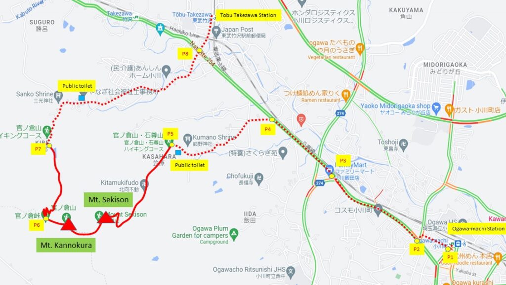
The course that walks Mt. Kannokura and Mt. Sekison is a hiking trail that represents Ogawa-mach. It is popular with hikers from far away. Please try it once.
	    Altitude  m
Mt. Sekison	 344.2
Mt. Kannokura	 344.2
Rute: Ogawa-machi station – Mt. Sekison – Mt. Kannokura – Tobu Takezawa station
Map
Point Walking distance from station km
P1 0.1
P2 0.4
P3 1.3
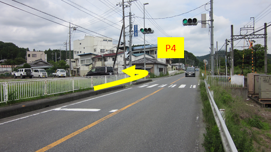
P4 2.1
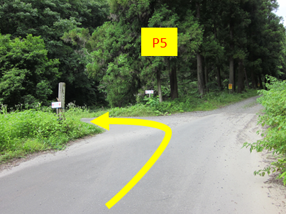
P5 3.0
Mt. Sekison 4.6
Mt. Kannokura 5.1
P6 5.4
P7 6.3
P8 8.3
Tobu Takezawa 8.5
Guide
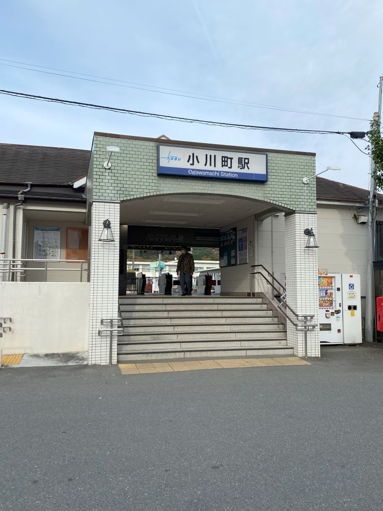
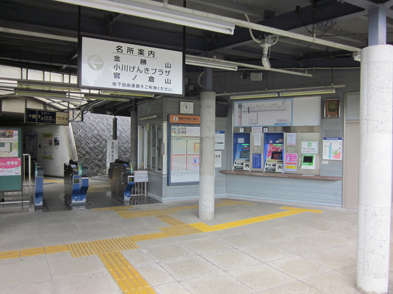
Start Ogawa-machi station
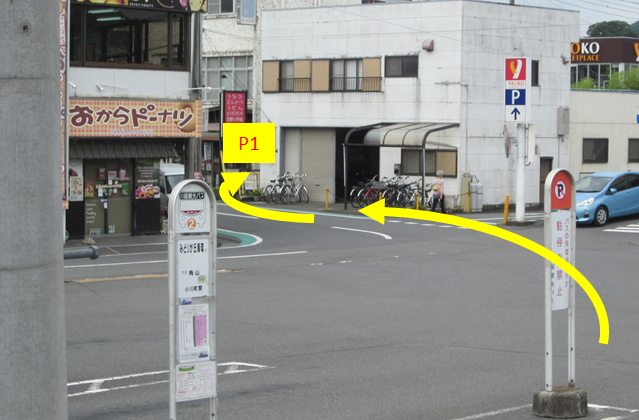
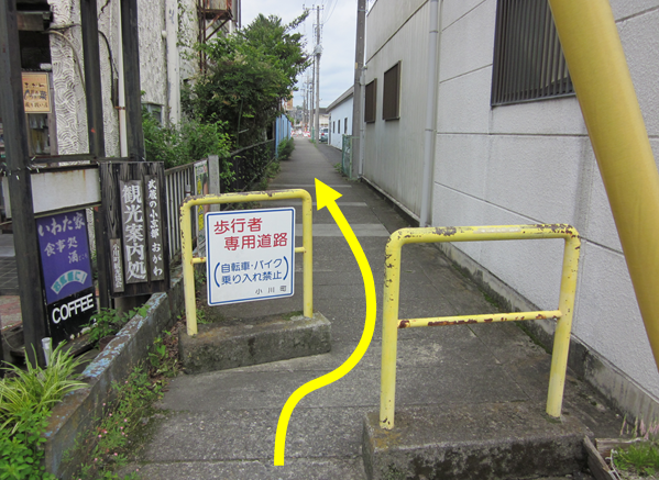
Exit the station and turn right.
Go through the pedestrian path.
Turn left at end of pedestrian path.
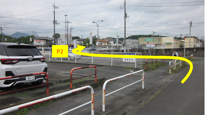
Cross the intersection and go north。
The convenience store at the corner of the intersection along the road is the last place you can get food and drinks.
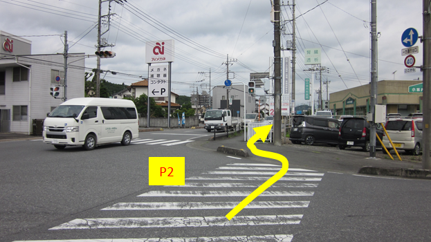
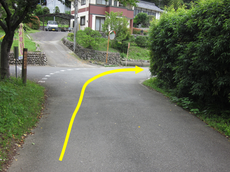
Turn left at this intersection.
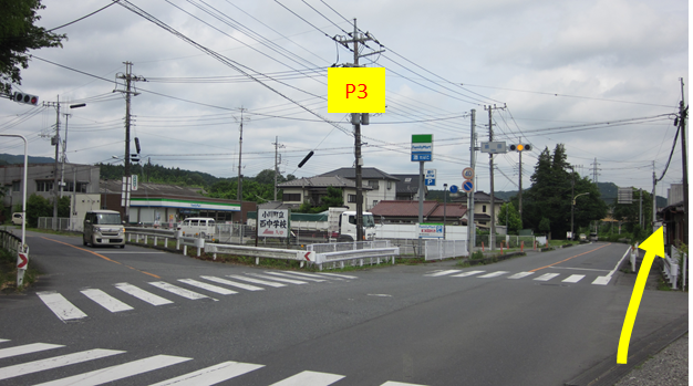
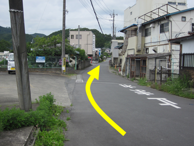
Turn left at this intersection.
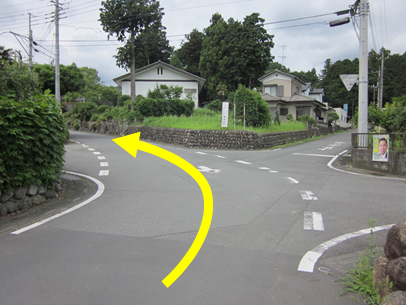
Follow the road.
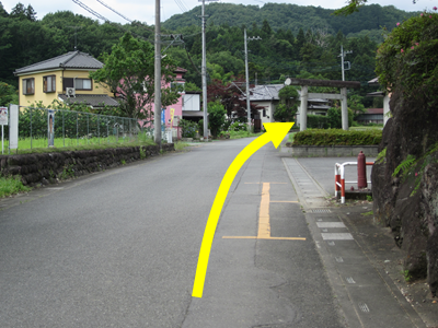
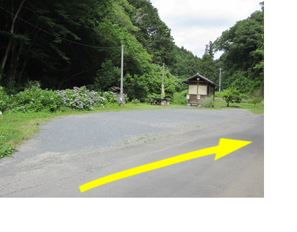
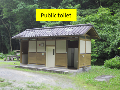
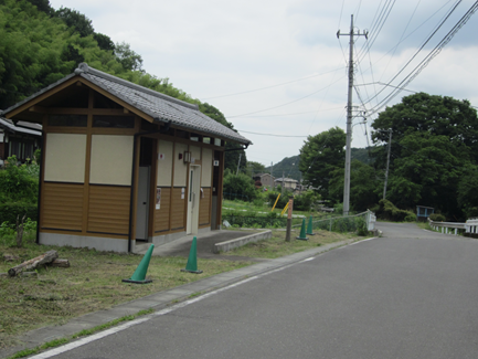
Go straight in front of the parking lot. You can come here by car. There is a toilet in the corner of the parking lot
This toilet is Japanese style. The central multifunctional toilet is Western style.
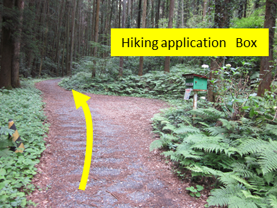
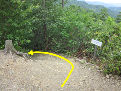
Go to a bit from the parking lot and turn left to enter the trail.
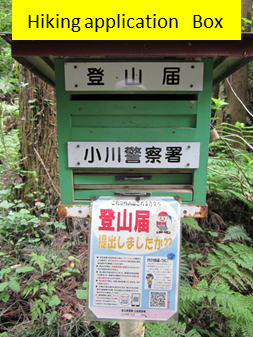
After walking for a while on the mountain trail, you will see a box for submitting a Hiking application on your right.
There should be application forms in the drawer, but those have been run out. Please download it from this site, fill it out in advance, and bring it with you. Put the paper into the box from the upper slit. It’s OK to read the QR code with your smartphone, but it’s probably in Japanese.
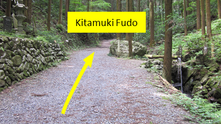
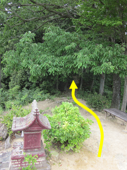
If you go for a while from the box, you will reach the place where there is a Kitamuki Fudo. There is a water outlet and you can drink a bit.
Fudo is located at the top of the stone steps on the left.
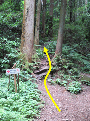
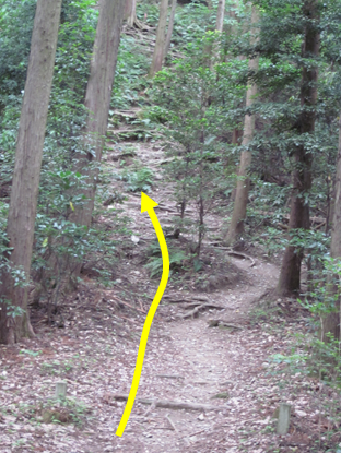
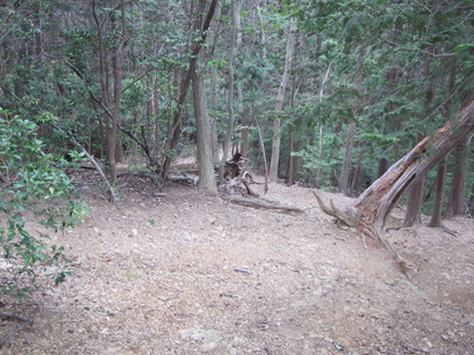
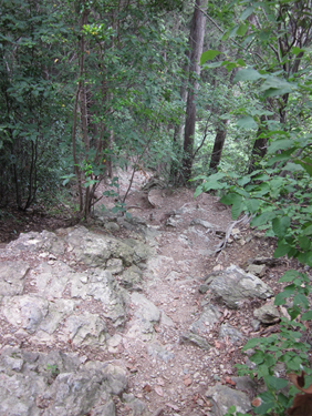
After a short distance, the road becomes narrow and steep, so watch out for rocks and tree roots.
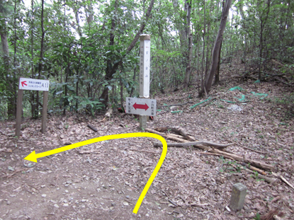
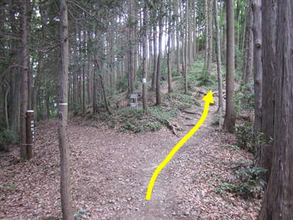
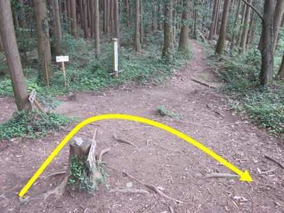
After walking for a while, you will reach a place with a guide sign. Turn sharp left here.
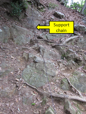
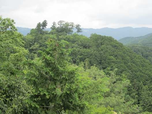
A steep climb along the ridge
As you approach the summit, it becomes a rocky area with support chains. Be careful and climb one by one.
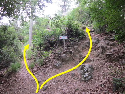
The path splits into two just before the summit, but you can reach the summit in either direction.
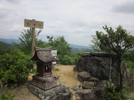
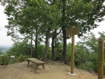
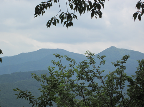
Top of Mt. Sekison There are shrines, signs, etc.
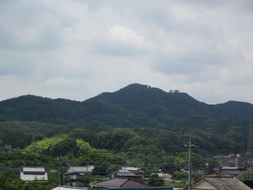
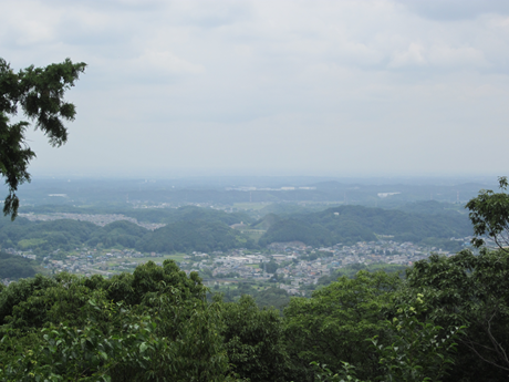
You can see the Ogawa-machi to the southeast.
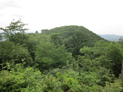
You can see the Mt. Kannokura to the northwest.
After taking a rest, go through the side of the bench.
Going a bit, it will become a steep descent, so go with caution.
In the halfway point, go straight. The left path is for Higashi Chichibu Village.
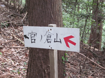
Follow this sign.
A bit climb takes you to the summit of Mt. Kannokura.
Mt. Sekison
Right: Mt. Kasa Left Mt. Dodaira
Take the path on the north side for descent.
The path is steeper and rougher than before, so go down carefully.
Go right at the fork at the bottom. Straight for Mt. Usuiri, Left for Higashichichibu Village
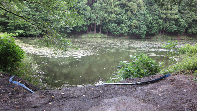
P7 There is a pond when you go down. Tennou-numa
Go east along the road.
There are public toilets along the way. Both sides are Japanese style as well as the toilet at the trailhead.
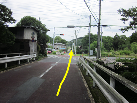
P8 At the intersection, follow the signal and go straight.
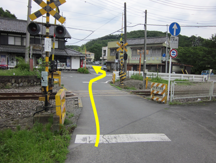
Go straight at the railroad crossing carefully.
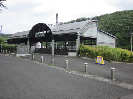
There is Tobu Takezawa Station along the road.
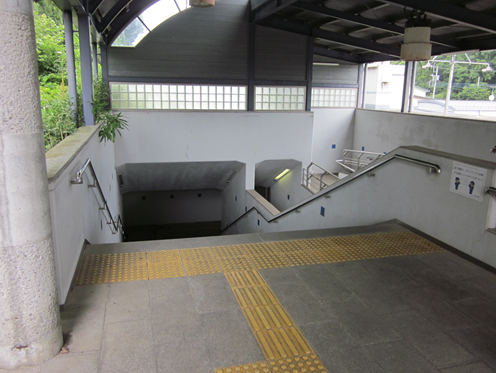
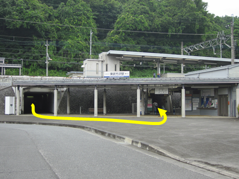
Go down the stairs inside the station and go through the underpass to the east gate.
After passing through the underpass, there is a ticket gate on your left.
That’s it for the guide. Thank you for your hard work. Please take care on your way home.